Drought dilemma: NJ finally had decent rain and even snow. Is the drought over?
While this week’s storm was needed and beneficial, it is not enough to end the drought. However, there are more opportunities for New Jersey to see rain or snow in the coming weeks.
Share:
More Stories
1:16

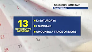
Streak of weekends with rain set to continue for lower Hudson Valley
16m ago0:26

Tree crushes car in Pelham Parkway
2ds ago
NOAA predicts above-average hurricane season for 2025
11ds ago1:17

Rainy roads, holiday traffic expected ahead of Memorial Day weekend
11ds ago1:18

Thunderbolt 12: Heavy rain at time is causing ponding and slick roadways throughout the Hudson Valley
11ds ago
LIVE RADAR: Track today's rain storm
12ds ago1:16

Streak of weekends with rain set to continue for lower Hudson Valley
16m ago0:26

Tree crushes car in Pelham Parkway
2ds ago
NOAA predicts above-average hurricane season for 2025
11ds ago1:17

Rainy roads, holiday traffic expected ahead of Memorial Day weekend
11ds ago1:18

Thunderbolt 12: Heavy rain at time is causing ponding and slick roadways throughout the Hudson Valley
11ds ago
LIVE RADAR: Track today's rain storm
12ds agoParts of New Jersey have seen repeated days of rain - and even some impressive snow accumulation. Since we finally had beneficial precipitation, the drought should be over, right?

Unfortunately, this is not the case. Parts of central and northern New Jersey have certainly seen an improvement in the precipitation department, following the storm system that has been lingering throughout our region since Wednesday evening. However, it will take more than one decent storm to end our severe to extreme drought.

The Middle Atlantic River Forecast Center releases updates based on various time frames indicating an area’s expected precipitation compared to the actual amount received. This is based on climate averages and what we usually expect to see for each county during the allotted time.
But just how much have we seen and how far off is that? As this storm lingers a bit longer, we will see a slight adjustment to the 90 day totals, but as of Nov. 22 around 1 p.m., here are our current departures from average:

During the past 90 days, Union County has seen 3.2 inches of precipitation so far. We need nine more inches to be near where we should be during this period.
Similarly, Passaic needs well over 9 1/2 inches combined with their collected 3.7 inches so far. Bergen and Morris counties have both seen around 3 1/2 inches of precipitation and need more than nine inches to be back to normal. Ocean County, which is in an extreme drought, is almost eight inches behind where it should be.
While this week’s storm was needed and beneficial, it is not enough to end the drought. However, there are more opportunities for New Jersey to see rain or snow in the coming weeks.
More from News 12
1:16

Streak of weekends with rain set to continue for lower Hudson Valley
2:23

Mostly sunny, hazy skies and warm with temps near 78 today
2:10

Connecticut strawberry crops taking a hit
2:19

Hazy sun, warm with highs near 80 today for Brooklyn
2:04

Hazy sun, warm with highs near 80 today for The Bronx
2:01
