Out-of-this-world display of storm clouds spotted across tri-state on Sunday
Clouds typically form as warm air rises - but mammatus clouds form upside down as cold air sinks, which very few other cloud types do.
Share:
More Stories
2:25

Possible pop-up storms overnight into Friday and Saturday in Brooklyn
2h ago1:58

Chance for possible showers overnight into Friday and Saturday for New Jersey
2h ago2:25

Chance for spotty showers overnight; unsettled weather continues for Friday and Saturday
4h ago1:27

Chance for scattered showers and storms during the evening on Independence Day
yesterday1:58

HOLIDAY FORECAST: Independence Day to feature warm temps with chance for evening storms
yesterday1:51

‘I’m afraid of flooding.’ New Jersey families stuck in Jamaica as Hurricane Beryl approaches
yesterday2:25
Possible pop-up storms overnight into Friday and Saturday in Brooklyn
2h ago1:58
Chance for possible showers overnight into Friday and Saturday for New Jersey
2h ago2:25
Chance for spotty showers overnight; unsettled weather continues for Friday and Saturday
4h ago1:27
Chance for scattered showers and storms during the evening on Independence Day
yesterday1:58
HOLIDAY FORECAST: Independence Day to feature warm temps with chance for evening storms
yesterday1:51
‘I’m afraid of flooding.’ New Jersey families stuck in Jamaica as Hurricane Beryl approaches
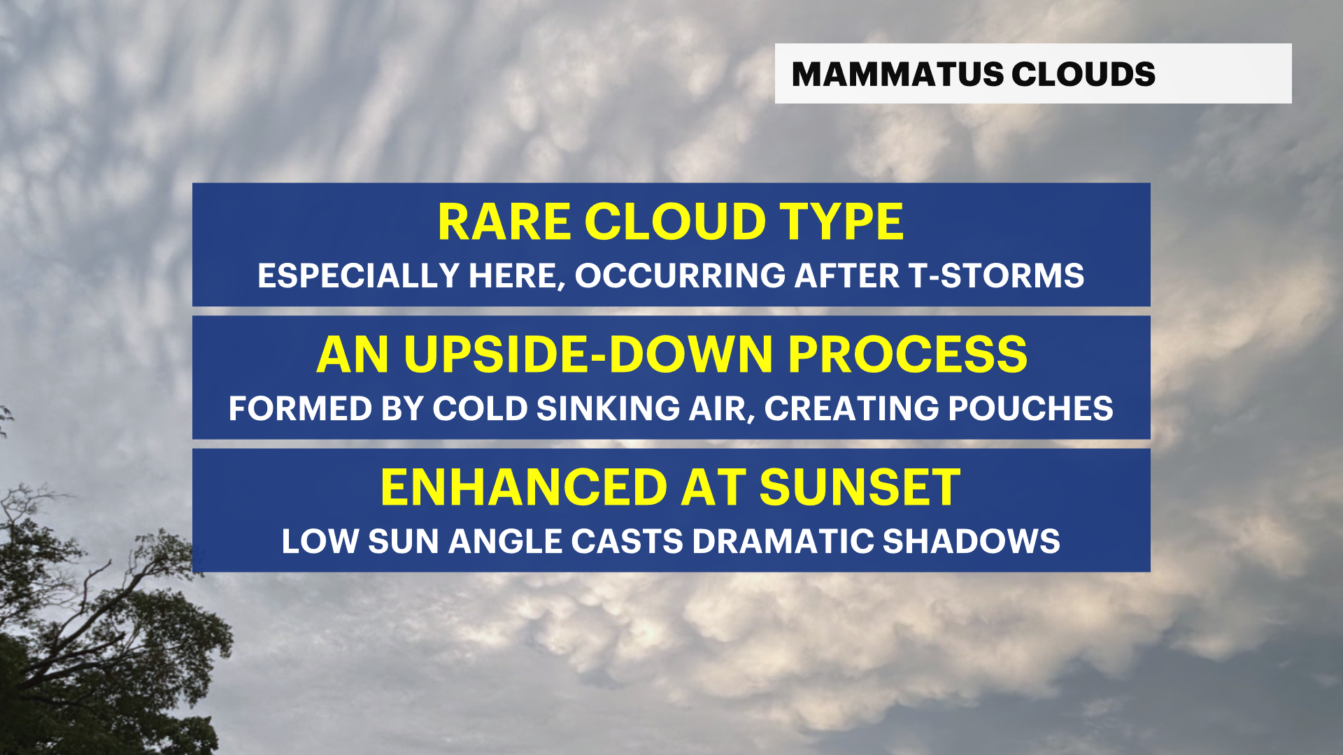
yesterdayMany in the tri-state area witnessed a rare display of mammatus clouds after the severe storms that drenched the region Sunday. And these clouds came just in time to create one of the more dramatic skies in recent memory.
What are mammatus clouds? And what makes them so rare?
First, there needs to be a brief science lesson on clouds themselves.
Clouds typically form as warm air rises - but mammatus clouds form upside down as cold air sinks, which very few other cloud types do.

This sinking motion creates a series of sagging, rounded pouches in the sky.
These clouds form on the underside of cumulonimbus anvils aka the clouds that produce thunderstorms once storms typically become severe.
Since Sunday was the largest severe weather outbreak in over a year, with numerous severe thunderstorms crossing the tri-state, that was the perfect opportunity for mammatus clouds to form.
What made these mammatus clouds even more breathtaking was the timing – right at sunset. The low angle of the sun helped enhance the dramatic highlights and shadows between the clouds and sunlight, making the pouches more pronounced and eye-catching.
Just take a look at some of the News 12 Storm Watch Team photos from our meteorologists and our viewers!


All of us witnessed and captured this rare phenomena Sunday evening.
If you ever have eye-catching weather photos, tag us using the hashtag #n12StormWatchers.


